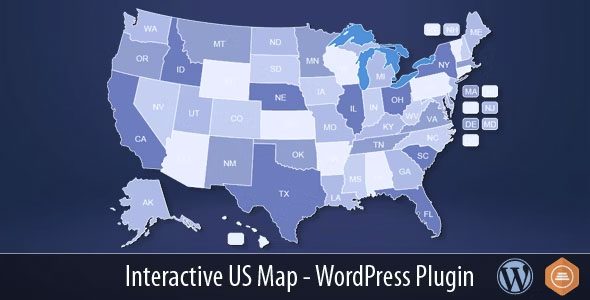
The Interactive US Map plugin is a powerful tool designed to help website owners seamlessly integrate a dynamic and engaging interactive US map into their WordPress sites. This feature-rich plugin allows users to create a professional-looking map with 50 clickable states plus Washington D.C., making it an ideal solution for businesses, organizations, and content creators who want to enhance user engagement and provide valuable geographical information. The latest version, Interactive US Map v2.7, offers improved customization options, better performance, and enhanced compatibility with the latest WordPress updates. By simply inserting a shortcode into any page or post, users can display the map with ease, offering a seamless experience for both administrators and visitors.
Real-World Use Cases
The Interactive US Map plugin is versatile and can be utilized across various industries and scenarios. For instance, real estate agencies can use it to showcase properties across different states, while e-commerce businesses can highlight regional shipping options. Educational institutions might integrate it to display campus locations, and non-profits can leverage it to track donations or volunteer activities by state. Additionally, news websites can employ the map to geographically contextualize stories, improving user interaction and searchability. The plugin’s ability to be customized further enables users to tailor the map to their specific needs, whether it’s displaying specific states, adding markers, or adjusting the color scheme.
Target Audience Profiles
The primary target audience for the Interactive US Map plugin includes:
- Small to Medium Business Owners: Particularly those in real estate, e-commerce, and local services who want to enhance their site’s geographical reach.
- Educational Institutions: Schools, universities, and training centers aiming to display multiple campus locations or event venues.
- Non-Profit Organizations: Groups focused on fundraising, advocacy, or community outreach that need to visualize regional impact.
- Content Creators and Bloggers: Individuals who produce travel, news, or educational content that benefits from interactive mapping features.
Specific Problems Solved
One of the key pain points addressed by the Interactive US Map plugin is the lack of an easy-to-use, customizable mapping solution for WordPress users. Many businesses and website owners struggle with static images or complicated third-party mapping tools that require extensive technical knowledge. The plugin solves this by providing a straightforward installation process and an intuitive interface for customization. Additionally, it resolves issues related to scalability and performance, ensuring that the map remains functional even on high-traffic websites.
Key Features of the Interactive US Map Plugin
The plugin offers numerous features that make it stand out in the WordPress ecosystem:
- 50 clickable states plus Washington D.C. for detailed geographical targeting
- Easy insertion via shortcode into any page or post
- Customizable appearance with color schemes, markers, and labels
- Option to display lakes, Alaska, Hawaii, and Washington D.C. selectively
- Support for multiple instances, allowing users to test different configurations
- Automatic updates via WordPress Admin or manual sFTP installation
- Compatibility with the latest WordPress versions and browser standards
Update and Maintenance Guide
Updating the Interactive US Map plugin is straightforward. Users can choose between two methods:
1. Via WordPress Admin: Go to the Plugins section, upload the new zip file (e.g., Interactive US Map v2.7.zip), and replace the old version. If prompted about a file structure change, it’s safe to ignore the warning.
2. Via sFTP: For advanced users, log in to the site’s files via sFTP, navigate to wp-content/plugins/us-map, and replace the existing files with those from the new zip file.
After updating, clear the cache (Ctrl+F5) to ensure the changes take effect. Users of version 2.2.0 or newer should note that state customization settings are preserved during updates but require rechecking the display options for lakes, Alaska, Hawaii, and DC. Additionally, the plugin allows for three installable instances, so users can test updates with us-map-ii.zip before replacing the main version.
Best Practices for Implementation
To maximize the effectiveness of the Interactive US Map plugin, consider the following tips:
- Use Relevant Shortcodes: Place the map in high-traffic areas such as the homepage, contact page, or blog posts where geographical context is valuable.
- Customize for Branding: Match the map’s colors and markers to your website’s design for a cohesive user experience.
- Leverage for SEO: Geographically relevant content can improve local SEO rankings, making the plugin a valuable asset for regional businesses.
For further insights, check out related resources such as real estate WordPress plugins, map customization tips, and geo-targeted content strategies. If you encounter any issues or need assistance, don’t hesitate to reach out for support—our team is dedicated to ensuring a smooth experience. The Interactive US Map plugin continues to evolve with user feedback, making it a reliable choice for anyone looking to add interactive geographical elements to their WordPress site.
1. AllPJ.com acts as an information storage service for user-uploaded digital resources
2. Copyright belongs to original creators: • Commercial resources are for personal testing/learning ONLY • Obtain commercial licenses for business use
3. DMCA Compliance: To report infringement, use our Takedown Form with: • Specific content URLs • Proof of ownership • Contact details (Response within 24 hours)